Please put an active hyperlink to our site (www.rusnature.info) when you copy the materials from this page
Russian Zapovedniks and National Parks
<<< National Park "Zabaikalsky"
| Index and Map | Zapovednik
"Bastak" >>>
Far East
This is the largest region, which can be referred to as the county of contrasts. In
fact, according to the famous traveler Przhevalsky, in the southern Primorye grapes twist
around the spruce stalks and tigers occur along with taiga bears, whereas on the sea shore
and the islands of the Arctic Ocean the winter dominates almost throughout the year (a
mean temperature above zero on the Vrangel Island is only recorded 12 days per year!).
Yakutia, the Khabarovsk Territory, the Magadan and Kamchatka regions contain vast
unpopulated areas. At the same time, the south of the Primorye Territory has been well
developed, with numerous enterprises, plants and mines, and famous port cities as
Vladivostok, Hakhodka, etc.
In the 1930s in the previously desert locality on the left-hand bank of Amur, the plant
city of Komsomolsk was built to send a railroad to the Pacific (Sovetskaya Gavan). Today
this city is connected to the Ust-Kut and Taishet via the Baikal-Amur railroad. The sea
northern city of Magadan in the upper reaches of the Kolyma River became notorious in the
Soviet times as the area of penal colonies and exile (still earlier that notoriety was
acquired by the Sakhalin Island). On Kolyma communication routes huge concentration camps
were situated, and numerous enterprises and construction sites of Chukotka and Kolyma were
created using the labor and human lives.
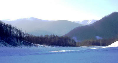
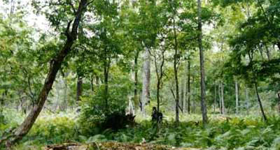
The nature of the Far East is not only diverse, but also rich. Particularly distinct in
this respect is the Primorye and southern Cis-Amur Region, which is determined by a
combination of several different geographic provinces (Manchurian, Siberian, Pacific,
etc.). The specific "Ussuri" flora and fauna occur only there and nowhere else.
Only its individual representatives penetrate almost to the mouth of the Amur River. This
fauna includes the Amur tiger, the Asiatic Black bear, Manchurian hare, Japanese crane,
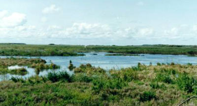
Chinese soft-shelled turtle, Manchurian black water snake, and numerous fish species. Lake
Khanka is characterized by a particular abundance of fish and birds, however, rice crops
and the use of chemical fertilizers have resulted in a heavy pollution of the water body.
In Amur, a pulp-and-paper integrated mill was constructed, which was similar to the
Baikal one, which has had a detrimental effect on the purity of the river and its
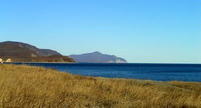
dwellers. The large Sakhalin Island is essentially taken up by taiga, the Kuril, Commander
and other smaller islands in the Pacific each have a peculiar appearance, each of which
meriting study and description.
The seas of the Far East are sources of the most valuable foods (fish, crabs, mussels,
etc.), and not only for our country.
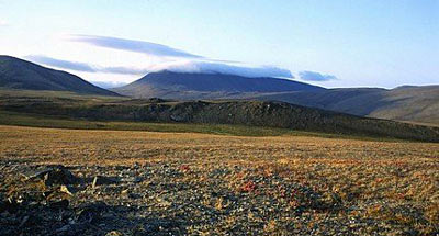
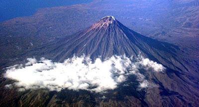
The gigantic peninsula of Kamchatka is well know for its volcanoes, geysers, specific
landscapes, which do not exist anywhere else, and an abundance of bears, which are the
biggest in Russia.
In southern Yakutia and the left-hand bank of Amur are the most hard of access and the
most sparsely populated mountain ranges (Stanovoi, Jugdyr, Jugdshur), north of them lie
the Aldanskoe and Patomskoe (Prilenskoe) Uplands or Plateaus. The taiga is dominated by
the larch, only in the southwestern Yakutia there occur cedar trees, but in the Primorye
and Cis-Amur Region, large areas were taken up of the peculiar Korean pine (cedar) with
very large nuts.
Unfortunately, the main cedar forests in Primorye have been cut out to be replaced by
derivative forests. In addition to the common spruce trees, the entire southern Far East
features some specific species for deciduous trees (oak, lindens, maples, ashes, poplar,
etc.). There are numerous fruit-bearing medicinal shrubs and even lianas (Actinidia, Amur
grapes).
The north-eastern Yakutia is occupied by large mountain ranges (Cherskii,
Suntar-Khayata and others, whose altitude above the sea level exceeds 3000 m). Flowing
between them are the broad rivers — Yana, Indigirka, and Kolyma.
The Verkhoyansk Territory is known ŕs the world center of cold and the lowest
temperatures on the Earth. The biggest river of Yakutia is the biggest river of Asia —
the great Lena with its main tributaries (Vilui on the left, and Aldan on the right).
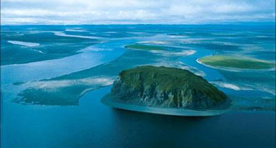
The shore of the Arctic Ocean faces a wide tundra zone. The same landscapes, along with
true polar deserts, dominate on the northern islands.
On the whole our Far East is so interesting, vast and diversified that you can only
feel sorry for people who have never seen it.
<<< National Park "Zabaikalsky"
| Index and Map | Zapovednik
"Bastak" >>>
|


